Cargando...
Recursos educativos
-
Nivel educativo
-
Competencias
-
Tipología
-
Idioma
-
Tipo de medio
-
Tipo de actividad
-
Destinatarios
-
Tipo de audiencia
-
Creador
Lo más buscado
- Actividades didacticas en tercero
- Teoría del arte
- Carga eléctrica para tercero
- imágenes escolares
- Rinoceronte
- Juegos experimentos
- Lobos
- cuentos inglés infantil
- Repaso de sintaxis
- Ángulos entre paralelas y ángulos interiores
- Aula interactiva la rueda de los alimentos
- Auxiliary verbs
- Imprimir material bachillerato de modalidad
- Horas del reloj niños
- Uso de c, q y k
-

World Voices
Ester Cladera Organización
- 786 visitas
Página web que ofrece la posibilidad de buscar audioguías o crear de propias.
-

World Voices
Ester Cladera Organización
- 508 visitas
Pàgina web que ofereix la possibilitat de cercar audioguies o crear-ne de pròpies.
-

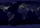
World map
Esdres Jaruchik Organización
- 645 visitas
The following link shows an image of the world map and night.
-

The representation of the Earth: maps
EduBook Organización
- 1 lo usan
- 7432 visitas
In the past, cartography (or map making) was a very slow process. It involved observation and complex calculations and drawings. Modern maps are made using aerial photos and images from satellites…
-

The representation of the Earth: maps
EduBook Organización
- 5764 visitas
2.1. Maps Maps are flat representations of the Earth's surface. To read and interpret a map we need to know its basic elements: scale and conventional signs. Scale Scale indicates how many times the…
-

Summaries - The representation of the Earth: maps
EduBook Organización
- 1 lo usan
- 5064 visitas
1. Latitude and longitude Geographical coordinates are imaginary horizontal and vertical lines that encircle the surface of the globe in a grid. There are two types: Parallels: hoirzontally encircle the…
-

Introduction - The representation of the Earth: maps
EduBook Organización
- 3485 visitas
In the past, cartography (or map making) was a very slow process. It involved observation and complex calculations and drawings. Modern maps are made using aerial photos and images from satellites…
-

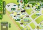
Maps skills: Interactive London zoo map
Maria Pallarés Docente
- 1 lo usan
- 3889 visitas
Students can explore the Zoo of London and find out more about its residents via this interactive map. This resource can be used to introduce some basic features of maps: finding places, orienteering,…
-

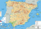
Physical Map of Spain - Ezilon Maps
Cristina Seco Organización
- 1 lo usan
- 2331 visitas
Physical map of Spain showing rivers, lakes, elevations and other topographic features. Populated areas are also shown.
-

Mind Mapping Software - Create online Mind Maps
Héctor Espinoza Hernández Docente
- 1 lo usan
- 2221 visitas
Create the best looking mind map online and share it with others. Enjoy mind mapping by brainstorming collaboratively on ideas and projects.
Te estamos redirigiendo a la ficha del libro...


