Cargando...
Recursos educativos
-
Nivel educativo
-
Competencias
-
Tipología
-
Idioma
-
Tipo de medio
-
Tipo de actividad
-
Destinatarios
-
Tipo de audiencia
-
Creador
Lo más buscado
- Conocimiento del medio natural, social y cultural
- Repaso bachillerato
- Ángulo adyacente
- Rocas magmáticas
- Educación Plástica y Visual
- Cine
- Actividades de geometría en primero
- Huesos del cuerpo humano bachillerato
- Experimentos de botánica educación infantil
- Letra ll
- Actividades cuerpo humano primaria
- Arte gótico para primero
- problemas de primaria
- Alimentación saludable en cuarto
- Guía de consumo responsable
-

Services in the neighborhood
Suzanne Teesdale Organización
- 794 visitas
Web page where students can find a map with the main services of their neighborhood: post office, fire station, hospital, school, library, etc.
-
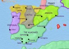
Spain and Portugal Middle Ages, by Interactive World History Atlas
Núria Termes Organización
- 686 visitas
History, map and timeline of Spain and Portugal in AD 1215, when the Christian kingdoms advance as Muslim Spain fragments into many small emirates.
-
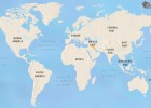
TimeMaps
V&V Books Vicens Vives Organización
- 376 visitas
A timeline of maps covering 5000-plus years of world history begins with a map of the ancient world in 3500 BC, showing the first civilizations
-

Observe. Europe's rivers and seas
EduBook Organización
- 5704 visitas
Look at the map of Europe's rivers and seas and answer the questions: Which oceans and seas border the European coastline? Which of the continent's seas is furthest north? And the furthest…
-

Look. Population density in Spain
EduBook Organización
- 4264 visitas
Look at the map and answer the questions: Which provinces have the densest populations? Which Autonomous Communities have the most uneven population distribution? The map shows some provinces that are…
-

Observe. Cities and empires of Mesopotamia
EduBook Organización
- 3585 visitas
Look at the map and answer the questions: Which rivers cross Mesopotamia? Why were the rivers important for the development of urban civilisations in this area? Describe the succession of kingdoms and…
-

10. Self-evaluation - The representation of the Earth: maps
EduBook Organización
- 2683 visitas
Choose the correct answer for these questions: What do we need to know to precisely locate a point on the Earth? What exactly is map scale? What would be the best type of map to locate the most…
-

Look. Nationalities of Europe in the 19th century
EduBook Organización
- 2561 visitas
Look at the map and answer the questions: Classify 19th century nationalities into their linguistic groupings. Make a four-column table using the information from the map. Why are the Russian, Austrian…
-
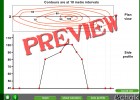
Contours
Tiching explorer Organización
- 2772 visitas
This is and interactive application to understand the correlation between contours on a map and the side profile of a geological feature. Students have to drag the dots on the X-axis to display the…
-

Identify. The Earth's landscapes
EduBook Organización
- 1 lo usan
- 1956 visitas
Look at the map and answer the questions: Identify the hot, temperate and cold climates zones on the map. Which zone is closest to the equator? Which zones are furthest away? Which climate zone is…
Te estamos redirigiendo a la ficha del libro...


